Forest Inventory System
Traditional field-based forest inventories are cost-prohibitive, time-intensive, and often infeasible across remote western landscapes. Open Range Consulting's Forest Inventory System solves this challenge by providing a scalable, landscape-wide solution for quantifying western juniper and other tree species structure in operationally challenging environments.
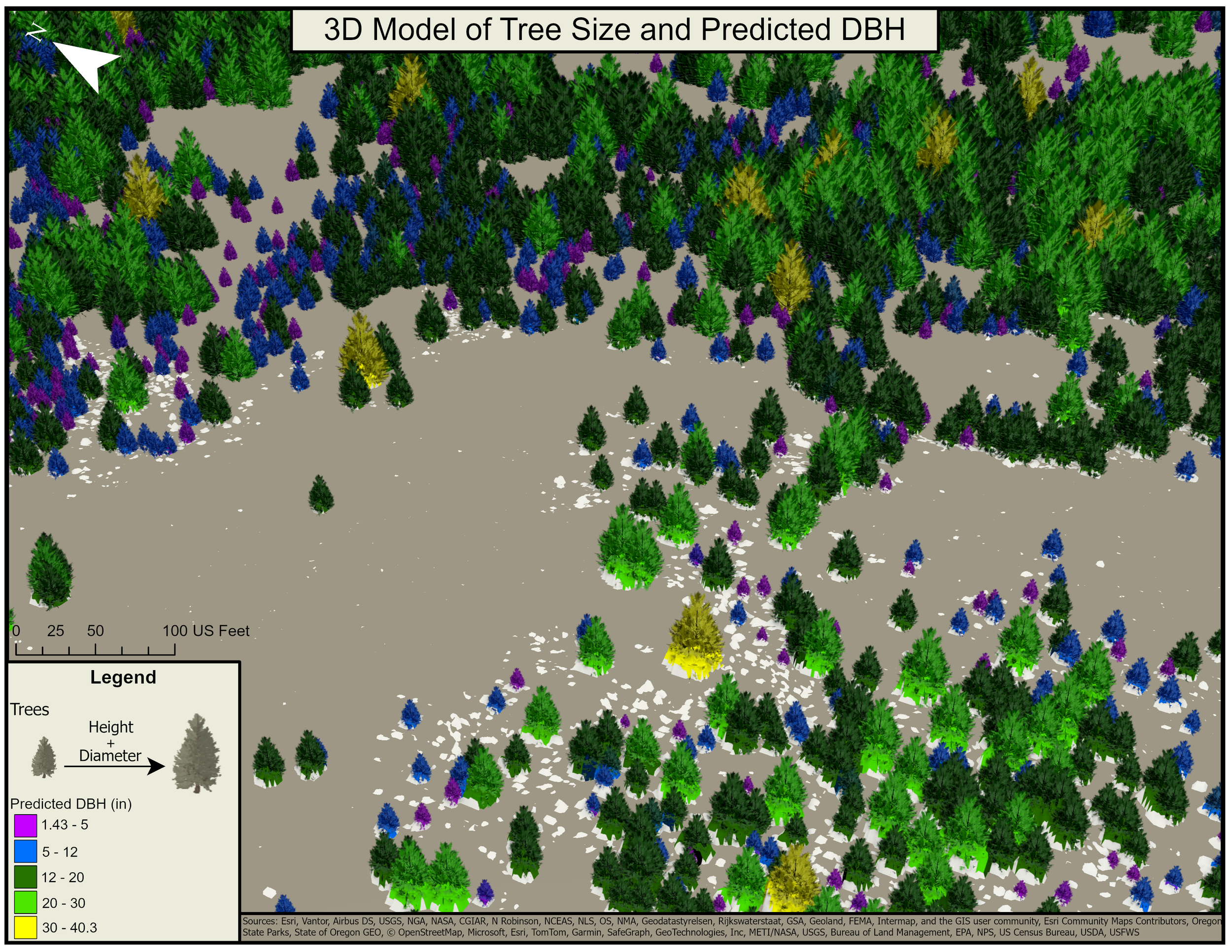
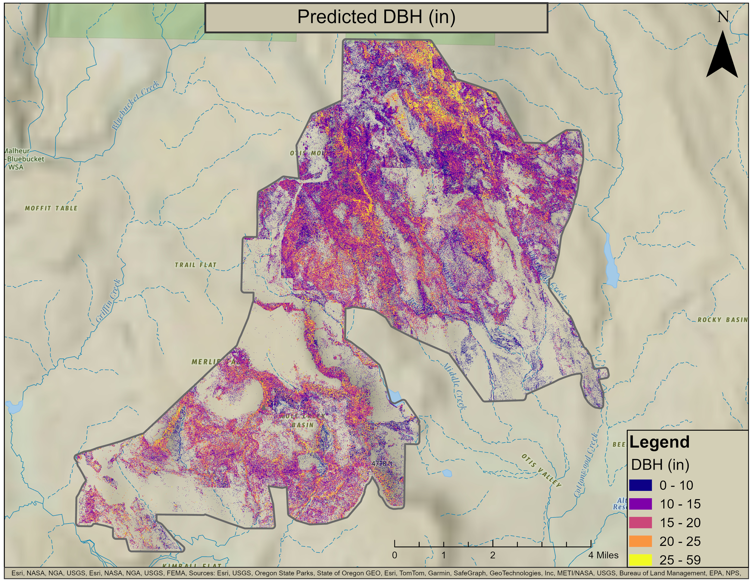
The system uses LiDAR-derived crown delineation and regression modeling trained on field measurements to estimate tree diameter and volume for each individual tree within a given project area, producing consistent, wall-to-wall inventory data across large management areas. Outputs can be generated for 1+ million trees per project, enabling comprehensive assessment without the cost, time, or access limitations of traditional approaches.
Inventory models are rigorously validated using stratified k-fold cross-validation and multiple accuracy metrics tailored to forestry applications. Performance is assessed across tree size classes and reported using metrics that reflect forest composition, ensuring predictions are reliable for operational decision-making across the full range of stand conditions.
This product supports data-driven decision-making for:
Fuel treatment planning: Identify priority areas and quantify pre/post-treatment biomass
Woodland encroachment assessment: Document expansion patterns and ecological impacts
Timber and biomass estimation: Generate volume and weight predictions for operational planning
Long-term monitoring: Establish baseline conditions and track landscape-scale change in inaccessible areas
By combining high-resolution remote sensing with scientifically rigorous, field-validated models, the Forest Inventory System delivers the comprehensive, reliable data for each individual tree that land managers need to design effective treatments, allocate resources strategically, and demonstrate management outcomes across complex landscapes.